Reality capture is often introduced through technology. New scanners, faster sensors, software updates and increasingly capable AI-assisted workflows tend to dominate conversations about the industry. Technology certainly matters, but after more than fifteen years working across reality capture, point clouds and geospatial data, I have come to see projects rather differently.
Most people begin by asking which scanner they should use. In my experience, that is rarely the first question. The better question is: What does the project actually need?
Only then does it make sense to decide which technologies, workflows and specialist knowledge will deliver the right result. That idea sits at the heart of how I approach every project.
The project defines the technology — not the other way around.
This article is an introduction to that way of thinking and the starting point of the Reality Capture Knowledge section. As new articles are published, each stage of the workflow introduced here will expand into dedicated technology guides, Field Notes and documented project examples.
Every Project Begins With a Question
Before choosing equipment, planning fieldwork or opening processing software, every project starts with an objective. What information is needed? Who will use it? How accurate does it need to be? What will happen to the data afterwards?
The answers to these questions influence every decision that follows. Two projects may appear similar on the surface yet require completely different workflows because their objectives are different. Understanding the project first almost always leads to better technical decisions later.
Capturing Reality
Reality capture begins in the physical world. The objective is straightforward: to collect reliable spatial information that can be transformed into useful digital data.
Today there are many different ways to capture that information, including terrestrial laser scanning, mobile mapping, SLAM-based systems, photogrammetry, UAV surveys and GNSS-supported workflows. Each has strengths, each has limitations and none of them is automatically the “best” technology. The right choice depends entirely on the project, the environment and the required outcome.
Throughout my career, I have worked across several of these workflows, and one lesson has remained remarkably consistent.
Good data starts with good planning.
The scanner only records what you choose to capture.
From Reality to Data
One of the biggest misconceptions I still encounter is that a point cloud is already the finished product.
It isn’t.
A point cloud is measurement data.
It is the digital representation of a real environment, created from millions or sometimes billions of measured points. That dataset often becomes the foundation for engineering documentation, survey drawings, BIM workflows, mesh generation, inspection, measurements, visualisation or digital twins.
The point cloud itself is rarely the final objective. It is one stage within a much larger process, and understanding that difference changes the way projects are planned from the very beginning.
Processing Is Where Information Begins to Take Shape
Collecting data is only one stage of a reality capture project. Once fieldwork is complete, the dataset needs to be transformed into something reliable, organised and usable.
Depending on the project, processing may include:
Registration
Georeferencing
Cleaning and optimisation
Quality assurance and quality control (QA/QC)
Dataset organisation
Classification
Export preparation
Deliverable preparation
This is where separate scans become a coherent dataset, errors are identified, data quality is verified and information is prepared for the people who will use it next. It is also one of the areas where I most often support project teams as an independent reality capture specialist.
Deliverables Are the Real Objective
Technology is rarely the final deliverable. Clients are not looking for a scanner, or even for a point cloud. They are looking for reliable information that supports the next stage of their project.
Depending on the objective, that deliverable may be a clean point cloud, a mesh, CAD drawings, BIM-ready data, measurements, technical documentation or something entirely different. Understanding the final objective helps determine every earlier decision in the workflow.
The deliverable should shape the process and not the other way around.
Choosing the Right Workflow
Modern reality capture offers more choices than ever before, which makes experience increasingly valuable. More data is not always better data. The newest technology is not automatically the right technology, and the fastest workflow is not always the most efficient once processing, quality control and project requirements are taken into account.
Good decisions come from understanding how the different parts of the workflow influence one another. Field decisions affect processing, processing decisions affect usability, and dataset structure affects downstream workflows. Every stage has consequences for the next.
That wider perspective has shaped the way I approach projects throughout my career.
An Evolving Technology Map
Reality capture continues to evolve. New sensors appear, software improves, automation becomes more capable and AI is beginning to reshape parts of the workflow.
The technologies will continue changing, but the underlying questions remain remarkably consistent: what needs to be captured, what level of accuracy and information is required, how should the data be processed and what does the final deliverable need to support?
Reality Capture Knowledge will continue to expand around these questions, with dedicated articles, practical guides, Field Notes and real project examples covering individual technologies and workflow stages.
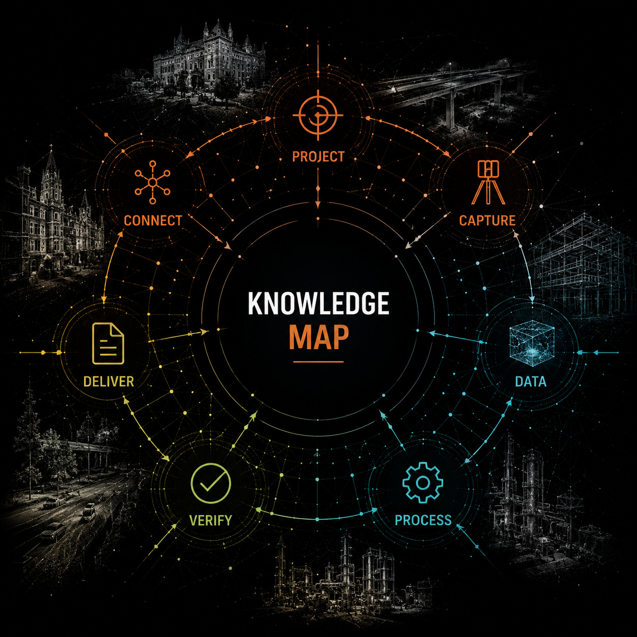
The Workflow at a Glance
Every completed project improves the next workflow.
Explore Reality Capture Knowledge
This article is the starting point.
From here, the knowledge base continues through three complementary types of content:
Reality Capture Knowledge →
Technical articles exploring the technologies, methods and decisions behind modern reality capture workflows.
Field Notes →
Shorter observations, technology encounters and practical lessons from field work and industry experience.
Projects →
Documented case studies showing how technologies, workflows and technical decisions are applied to real projects.
Whether you are new to reality capture or already working with spatial data, I hope these resources help you understand not only the technologies themselves, but also the thinking behind using them effectively.
Reality capture is not about the scanner. It is about understanding the entire workflow.
Let’s stay connected.
RdesignR is where I share projects, technologies, lessons and practical experience from my work in reality capture and spatial data.
If you work in this field, are exploring these technologies, or simply find this world as interesting as I do, I’d be glad to have you along.